
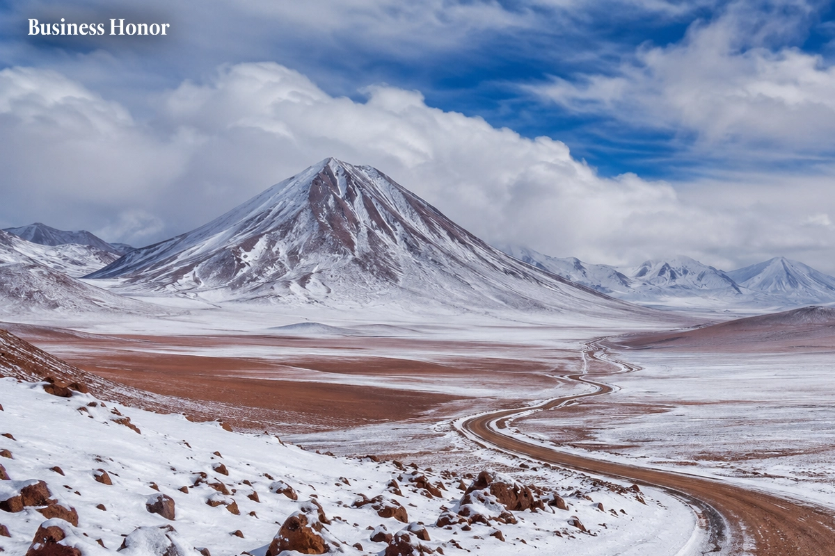
Atacama Desert Snow has covered parts of northern Chile after rare winter storms brought heavy snow and rain to one of the driest places on Earth.
|
Atacama Desert Snow has given parts of northern Chile an unusual winter makeover. Snow covered sections of the Atacama Desert in August 2026 after a series of storms moved across the region. NASA satellite images captured the desert under a layer of white.
The sight is unusual. The Atacama is one of the driest places on Earth. Some parts receive almost no rain. Its dry and barren terrain has even been used by NASA for spacecraft research because of its similarities to Mars.
So how did snow reach a place this dry?
The answer starts high in the atmosphere. A pocket of low pressure broke away from the main jet stream and moved across the Southern Hemisphere. At the same time, moist air was sitting near the Chilean coast.
That mix brought cold air and moisture into northern Chile. Snow fell across areas that normally see very little precipitation.
One of the worst-hit areas was the high-altitude Chajnantor plateau. It is home to ALMA, the Atacama Large Millimeter/submillimeter Array. Heavy snow and strong winds forced the observatory to pause operations and put its antennas into protective mode.
Then another storm moved in later in August. This one traveled much farther west. Snow crossed the dry heart of the Atacama and reached areas close to the Pacific coast near Antofagasta.
Was the snow really the strangest part of the storm?
Not quite. The rain was just as remarkable. Taltal received nearly 40 millimeters of rain in three days. That is around 10 times the city’s average yearly rainfall.
El Niño weather also played a role. It weakened the high-pressure system over the Pacific that usually helps keep the Atacama dry. Storms were then able to move closer to northern Chile.
Does this mean the Atacama is becoming wetter?
There is no evidence from this event alone to make that claim. Snow has fallen in the Atacama before, including during a storm in June 2025. Other deserts have also seen unusual snowfall, including parts of Saudi Arabia in December 2025.
What makes the 2026 Chile snowfall stand out is its reach. The storm carried snow across a huge stretch of the desert.
Business Honor examines that the scene may disappear as quickly as it arrived. But Atacama weather has once again shown that even the driest corners of the planet can produce surprises.








































.webp)

.webp)



.webp)



Comments
0 Comments